
Cabo Rojo, Puerto Rico: Lighthouse, Salt Flats, Playuela & Beaches
Explore historic maritime landmarks, protected coastal landscapes and beach communities across southwest Puerto Rico.
Places, stories and experiences
One municipality, many landscapes
Cabo Rojo brings together limestone cliffs, salt flats, beaches and coastal communities. It works best as a regional itinerary rather than a single stop. The salt flats and lighthouse tell stories of navigation and coastal livelihoods, while Boquerón, Combate and Buyé offer different ways to spend a day. The attractions are spread out, so choose a primary area rather than assuming they are within walking distance.
Salt flats: a landscape with a history
The Cabo Rojo salt flats are part of a place with cultural and ecological importance. Their color varies with natural conditions, so no visit should be sold as a guarantee of bright-pink water. The area matters for birds and species adapted to saline environments. It also offers context on salt production, conservation and the distinctive dry-coast scenery of southwest Puerto Rico. See the salt flats on Google Maps.
Los Morrillos Lighthouse and Caribbean navigation
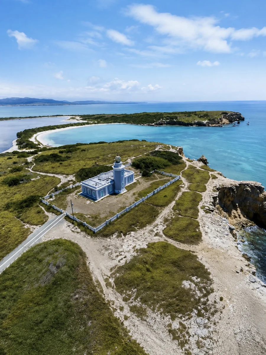
Los Morrillos Lighthouse stands above dramatic cliffs, making its maritime significance easy to understand from the landscape itself. Discover Puerto Rico places its construction in the nineteenth century and describes its role near the Mona Passage. Confirm current opening conditions if entering the lighthouse matters; access to the surrounding area can also change. See Los Morrillos Lighthouse on Google Maps.
Playuela beneath the cliffs
La Playuela, also known as Playa Sucia, lies near the lighthouse in a striking natural setting. It should not be described as a fully serviced beach with lifeguards, showers and food concessions: Discover Puerto Rico warns that such facilities are absent. Reaching it may involve walking and exposure to sun. See Playuela on Google Maps.
Boquerón: a coastal town atmosphere
Boquerón combines a coastal-town feel with places to stroll, dine and enjoy the beach area when conditions permit. A village visit has a different rhythm from the salt flats or lighthouse. The town is more social in character, while the refuge and cliffs invite quieter time observing scenery. See Boquerón on Google Maps.
Buyé and Combate: beaches with different moods
Buyé Beach and Combate Beach are alternatives for spending several hours on the coast. Choose according to atmosphere, water conditions, parking and what services are operating. Neither beach should be described as always calm or inherently safe for swimming: check marine conditions and official notices before entering the water.
Seafood and coastal dining around Joyuda
The Joyuda area is known for seafood and waterfront dining, as documented by Discover Puerto Rico. At this draft stage, the guide explains the area’s culinary character rather than declaring individual restaurants “the best” without checking each one. See Joyuda on Google Maps to locate the corridor; a future dining expansion can provide individually sourced business profiles.
Touring Cabo Rojo without rushing
A shorter visit might focus on the salt flats, lighthouse and Playuela if access and conditions allow. Another outing could center on Boquerón and a beach. Roads, trails and natural areas have different constraints, so a flexible itinerary is more realistic than rushing between every point. Any private transportation proposal should be confirmed for the specific route, availability and permissible access points.
Before you go
Check the weather and sea conditions for beach visits, and review access notices for nature reserves.
Frequently asked questions
Can I walk between all these sights?
No. The attractions are spread across different parts of the municipality.
Does Playuela have lifeguards?
Discover Puerto Rico reports no lifeguards or visitor facilities there.
Is the lighthouse always open?
No. Confirm current access and official notices before your trip.
Sources and useful links
Discover Puerto Rico — qué hacer en Cabo RojoDiscover Puerto Rico — Cabo Rojo beachesDRNA — Plan Maestro de Recursos CosterosDRNA — Programa de Monitoría de PlayasWe can review your request based on the route and availability. Tickets and third-party activities are booked separately.
Ask via WhatsApp